GIS Courses
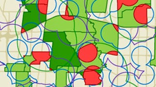
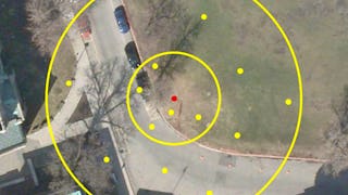
GIS courses can help you learn spatial analysis, cartography, remote sensing, and data visualization techniques. You can build skills in geographic data management, interpreting satellite imagery, and creating interactive maps. Many courses introduce tools like ArcGIS and QGIS, that support analyzing geographic information and presenting findings effectively. You’ll also explore applications in urban planning, environmental monitoring, and disaster management, allowing you to apply your knowledge in various practical contexts.
Popular GIS Courses and Certifications

University of California, Davis
Skills you'll gain: ArcGIS, GIS Software, Geographic Information Systems, Public Health and Disease Prevention, Public Health, Land Management, Geospatial Information and Technology, Geospatial Mapping, Spatial Analysis, Epidemiology, Community Health, Spatial Data Analysis, Land Development, Social Determinants Of Health, Emergency Response, Environmental Science, Natural Resource Management, Emergency Services, Business Development, Environment and Resource Management

Skills you'll gain: Geographic Information Systems, Geospatial Information and Technology, GIS Software, Geospatial Mapping, Spatial Data Analysis, Spatial Analysis, Global Positioning Systems, Data Analysis, Data Integration, Decision Support Systems
University of Toronto
Skills you'll gain: Spatial Data Analysis, Spatial Analysis, Geographic Information Systems, Geospatial Mapping, ArcGIS, Geospatial Information and Technology, GIS Software, Data Manipulation, Data Synthesis, Data Visualization, Data Compilation, Interactive Data Visualization, Data Processing, Data Wrangling, Data Mapping, Data Storytelling, Metadata Management, Data Integration, Graphic and Visual Design, Data Management

Skills you'll gain: Geospatial Information and Technology, Interactive Data Visualization, Geospatial Mapping, Geographic Information Systems, Graphic and Visual Design, Spatial Data Analysis, Design Elements And Principles, Generative AI, Color Theory, AI Workflows, Usability

Coursera
Skills you'll gain: GIS Software, Spatial Data Analysis, Geographic Information Systems, Geospatial Information and Technology, Geospatial Mapping, Data Import/Export, Visual Design, User Interface (UI)
University of Toronto
Skills you'll gain: Geographic Information Systems, Geospatial Information and Technology, Geospatial Mapping, GIS Software, Data Mapping, Spatial Data Analysis, Metadata Management, Quantitative Research, Spatial Analysis, Typography, Data Cleansing, Data Manipulation, Design Elements And Principles, Data Import/Export

University of California, Davis
Skills you'll gain: Spatial Analysis, ArcGIS, Geospatial Information and Technology, Geographic Information Systems, Geospatial Mapping, GIS Software, Data Quality, Data Mapping, Data Modeling, Database Design, Data Storage Technologies, Data Management, Data Storage, Data Sharing, Data Manipulation, Data Capture, Relational Databases, Query Languages, Analytics

L&T EduTech
Skills you'll gain: Geospatial Information and Technology, Spatial Analysis, GIS Software, Spatial Data Analysis, Geographic Information Systems, Geospatial Mapping, Construction Engineering, Database Management, Database Management Systems, Construction, Construction Management, ArcGIS, Relational Databases, Visualization (Computer Graphics), Civil and Architectural Engineering, Global Positioning Systems, Data Mapping, Building Information Modeling, Survey Creation, Engineering, Scientific, and Technical Instruments
Skills you'll gain: GIS Software, Geographic Information Systems, Spatial Data Analysis, Geospatial Information and Technology, Spatial Analysis, Geospatial Mapping, Data Validation, Metadata Management, Data Quality, Verification And Validation, File Management, Package and Software Management, Development Environment, Software Installation

Coursera
Skills you'll gain: Environmental Monitoring, Spatial Data Analysis, GIS Software, Geospatial Information and Technology, Geographic Information Systems, Data Literacy, Spatial Analysis, Geospatial Mapping, Data Visualization, Environmental Science, Model Evaluation, Data Validation, Verification And Validation, Data Manipulation

Skills you'll gain: Spatial Data Analysis, Spatial Analysis, Geographic Information Systems, Geospatial Information and Technology, Geospatial Mapping, GIS Software, Data Analysis, Data Visualization, Analytics, Interactive Data Visualization, Google Cloud Platform, Network Analysis, Query Languages

Case Western Reserve University
Skills you'll gain: Exploratory Data Analysis, Spatial Data Analysis, Spatial Analysis, Geospatial Mapping, Geospatial Information and Technology, Descriptive Statistics, Statistical Modeling, R Programming, Statistical Analysis, R (Software), Probability & Statistics, Statistical Programming, Data Wrangling, Data Analysis, Simulations, Statistical Methods, Rmarkdown, Data Cleansing, Box Plots, Plot (Graphics)
In summary, here are 10 of our most popular gis courses
- GIS Applications Across Industries: University of California, Davis
- GIS Mastery: Spatial Data, Remote Sensing, Decision Support: Coursera
- GIS, Mapping, and Spatial Analysis Capstone: University of Toronto
- Visualization, Web Mapping & Cloud GIS: Coursera
- Map Fast in QGIS: Coursera
- GIS Data Acquisition and Map Design: University of Toronto
- GIS Data Formats, Design and Quality: University of California, Davis
- Geospatial Techniques for Engineers: L&T EduTech
- Geospatial Foundations & Vector Analysis : Coursera
- Explore LiDAR in 3D: Coursera


